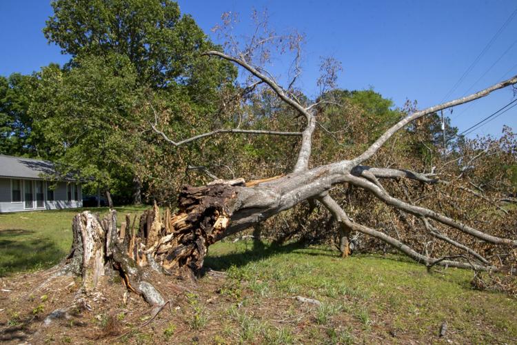
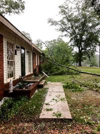
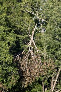
On Sunday morning, April 19, 2020, a mighty and underestimated severe thunderstorm blew across Coosa and Tallapoosa counties and other select portions of Central Alabama. In an instant, numerous home landscapes; a campground; backyards; front yards; orchards; forest settings;and roadsides were abruptly uprooted, transformed and damaged. A powerful straight-line wind punched the area and broke tree limbs; pushed over mighty and massive oaks,;snapped historic pines with ease; flattened generational pecan trees; and scarred the natural landscape. Luckily, only a few houses and buildings were badly damaged by the storm, but many beautiful shaded home landscapes were abruptly changed.
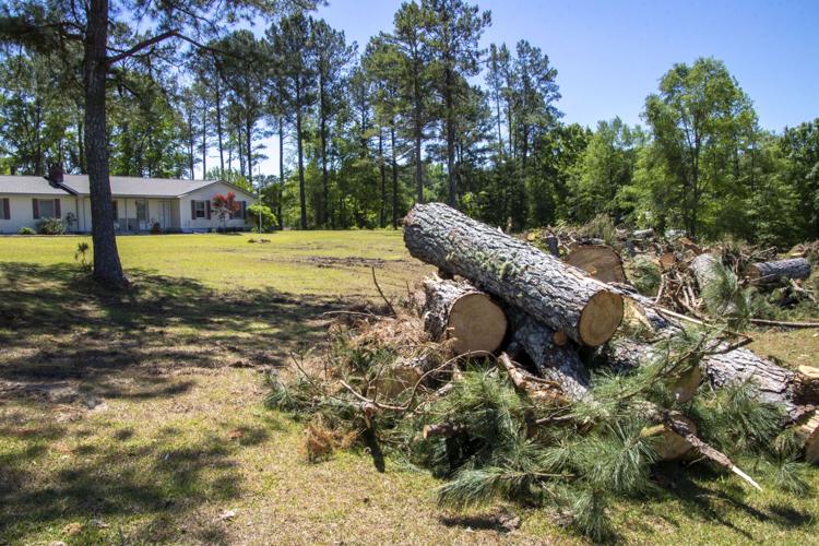
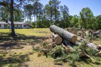
Now that the chainsaws are silent and much of the debris has been cleaned up and hauled away, attention turns to evaluating the yard and property. The obvious realization after such a storm event is that what once may have been a shady lot is now in full sun with the trees gone. Such drastic changes, indeed, will have long-term effects.
...WIND ADVISORY NOW IN EFFECT UNTIL 7 PM CDT THIS EVENING...
...FREEZE WARNING REMAINS IN EFFECT FROM 10 PM THIS EVENING TO 10 AM
CDT TUESDAY...

* WHAT...For the Wind Advisory, west winds 10 to 20 mph with gusts
up to 40 mph. For the Freeze Warning, sub-freezing temperatures as
low as 23 in the north and 28 in the south expected.

* WHERE...All of Central Alabama

* WHEN...For the Wind Advisory, until 7 PM CDT this evening. For the
Freeze Warning, from 10 PM this evening to 10 AM CDT Tuesday.

* IMPACTS...Gusty winds will blow around unsecured objects. Trees
could be blown down and a few power outages may result. Frost and
freeze conditions could kill crops, other sensitive vegetation and
possibly damage unprotected outdoor plumbing.

PRECAUTIONARY/PREPAREDNESS ACTIONS...

Winds this strong can make driving difficult, especially for high
profile vehicles. Use extra caution.

Secure outdoor objects.

Take steps now to protect tender plants from the cold.

To prevent freezing and possible bursting of pipes they should be
wrapped, drained, or allowed to drip slowly.

Those that have in ground sprinkler systems should drain them and
cover above ground pipes to protect them from freezing.

&&