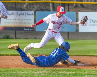
Samuel Higgs / TPI Horseshoe Bend's Bryce Jordan looks to tag a Reeltown baserunner at second base on Tuesday. The Generals scored three runs in the bottom of the fifth to come away with the win.
Bunts and timely runs were all that the Horseshoe Bend baseball team needed on Tuesday.
In the Generals' second matchup against the Reeltown Rebels this season, they were the ones who got the better end of things with a 3-1 win at home. Similar to the first matchup, the Rebels struck first and early, with a walk bringing in the first run of the day.
Samuel Higgs / TPI Horseshoe Bend's Bryce Jordan looks to tag a Reeltown baserunner at second base on Tuesday. The Generals scored three runs in the bottom of the fifth to come away with the win.
...WIND ADVISORY REMAINS IN EFFECT UNTIL 7 PM CDT THIS EVENING...
...FROST ADVISORY IN EFFECT FROM 1 AM TO 10 AM CDT FRIDAY...

* WHAT...For the Wind Advisory, north winds 5 to 15 mph with gusts
up to 30 mph. For the Frost Advisory, temperatures as low as 36
will result in frost formation.

* WHERE...Autauga, Bibb, Blount, Calhoun, Chambers, Cherokee,
Chilton, Clay, Cleburne, Coosa, Dallas, Etowah, Fayette, Greene,
Hale, Jefferson, Lamar, Lowndes, Marengo, Marion, Perry, Pickens,
Randolph, Shelby, St. Clair, Sumter, Talladega, Tallapoosa,
Tuscaloosa, Walker, and Winston Counties.

* WHEN...For the Wind Advisory, until 7 PM CDT this evening. For the
Frost Advisory, from 1 AM to 10 AM CDT Friday.

* IMPACTS...Gusty winds will blow around unsecured objects. Trees
could be blown down and a few power outages may result. Frost
could harm sensitive outdoor vegetation. Sensitive outdoor plants
may be killed if left uncovered.

PRECAUTIONARY/PREPAREDNESS ACTIONS...

Winds this strong can make driving difficult, especially for high
profile vehicles. Use extra caution.

Secure outdoor objects.

Take steps now to protect tender plants from the cold.

&&


