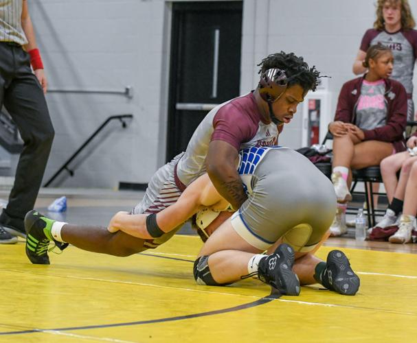
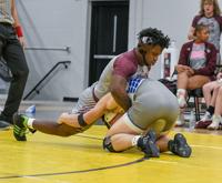
Samuel Higgs / TPI Benjamin Russell's Brandon Hicks, top, menevours on top of Reeltown's Ethan Hill looking for a way to pin. The Wildcats finished 1-1 against Reeltown and Dadeville on Wedndesday night.
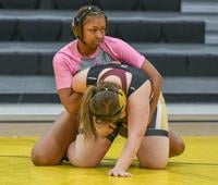
Samuel Higgs / TPI Benjamin Russell's Brooklyn Cottingham, right, looks to her corner while wrestling Dadeville's Rumor Howard. Cottingham sits at 37-1 this season for the Wildcats.
It’s practically that time in the wrestling season where things start to ramp up, and the Wildcats are starting to feel it.
Since hosting the Class 6A Region Duals last Thursday, the Benjamin Russell boys wrestling team has participated in three matches over a five-day stretch, while the girls team shares the same fate. And heading into the tri-match against Dadeville and Reeltown, the Wildcats had just less than a day's rest. There was still some rust from the match a day prior, according to BRHS coach Michael Ransaw.
Samuel Higgs / TPI Benjamin Russell's Brandon Hicks, top, menevours on top of Reeltown's Ethan Hill looking for a way to pin. The Wildcats finished 1-1 against Reeltown and Dadeville on Wedndesday night.
Samuel Higgs / TPI Benjamin Russell's Brooklyn Cottingham, right, looks to her corner while wrestling Dadeville's Rumor Howard. Cottingham sits at 37-1 this season for the Wildcats.


