PHOTOS: Stanhope Elmore hosts Holtville for rivalry revival


More like this...


Ana Sofia Meyer / TPI Holtville second baseman Cole Parrish (5) picks up a ground ball against Stanhope Elmore.
- Ana Sofia Meyer
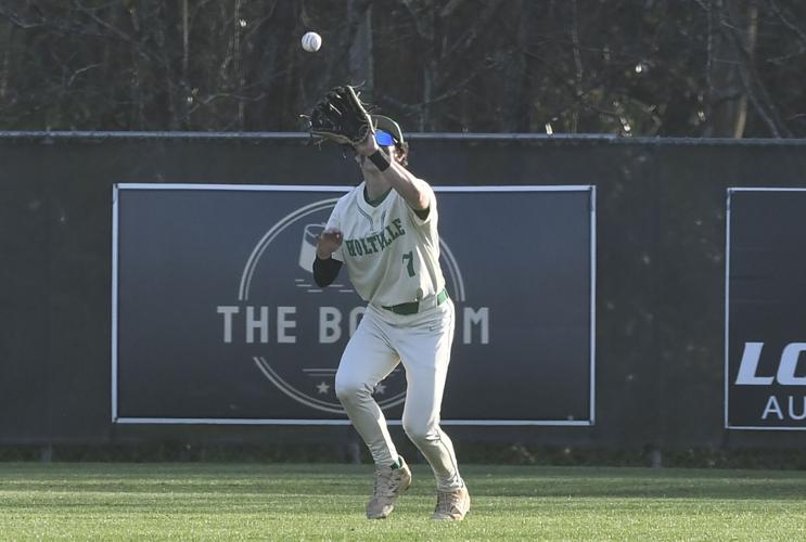

Ana Sofia Meyer / TPI Holtville's centerfielder Gage Russom (7) catches the flyout at Stanhope Elmore.
- Ana Sofia Meyer


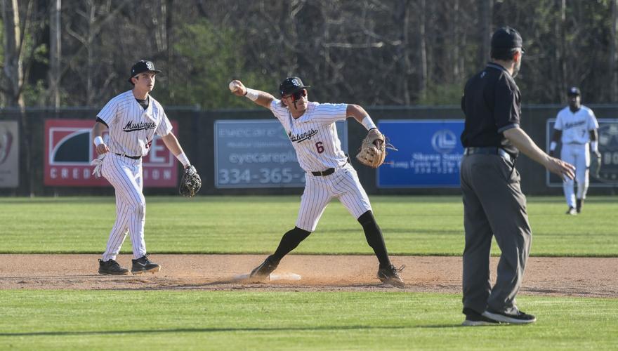

Ana Sofia Meyer / TPI Stanhope Elmore shortstop Hayden Anderson (6) makes a double play with a throw to first base.
- Ana Sofia Meyer


Ana Sofia Meyer / TPI Stanhope Elmore centerfielder Cavarous Ellis catches a flyout against Holtville.
- Ana Sofia Meyer


More like this...

Ana Sofia Meyer
Sports Writer
Get email notifications on {{subject}} daily!
Your notification has been saved.
There was a problem saving your notification.
{{description}}
Email notifications are only sent once a day, and only if there are new matching items.
Followed notifications
Please log in to use this feature
Log In
Don't have an account? Sign Up Today
Weather Alert
...WIND ADVISORY REMAINS IN EFFECT UNTIL 7 PM CDT THIS EVENING...
...FROST ADVISORY IN EFFECT FROM 1 AM TO 10 AM CDT FRIDAY...

* WHAT...For the Wind Advisory, north winds 5 to 15 mph with gusts
up to 30 mph. For the Frost Advisory, temperatures as low as 36
will result in frost formation.

* WHERE...Autauga, Bibb, Blount, Calhoun, Chambers, Cherokee,
Chilton, Clay, Cleburne, Coosa, Dallas, Etowah, Fayette, Greene,
Hale, Jefferson, Lamar, Lowndes, Marengo, Marion, Perry, Pickens,
Randolph, Shelby, St. Clair, Sumter, Talladega, Tallapoosa,
Tuscaloosa, Walker, and Winston Counties.

* WHEN...For the Wind Advisory, until 7 PM CDT this evening. For the
Frost Advisory, from 1 AM to 10 AM CDT Friday.

* IMPACTS...Gusty winds will blow around unsecured objects. Trees
could be blown down and a few power outages may result. Frost
could harm sensitive outdoor vegetation. Sensitive outdoor plants
may be killed if left uncovered.

PRECAUTIONARY/PREPAREDNESS ACTIONS...

Winds this strong can make driving difficult, especially for high
profile vehicles. Use extra caution.

Secure outdoor objects.

Take steps now to protect tender plants from the cold.

&&
Currently in Alexander City
49°
Mostly Cloudy
50° / 46°
12 PM
50°
1 PM
53°
2 PM
55°
3 PM
58°
4 PM
59°
Copyright 2026 TPI Media Group
| Terms of Use
| Privacy Policy
Powered by BLOX Content Management System from BLOX Digital.


