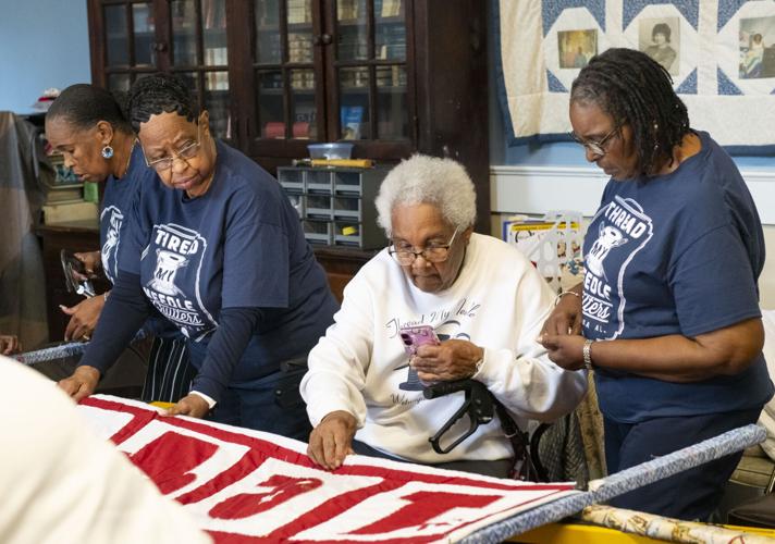
Cliff Williams / TPI Even at 96, Jacqueline Lacey of Wetumpka, still passes on her knowledge of quilting. Her she is helping put a quilt on a frame for repair.
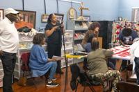
Cliff Williams / TPI Tonea Stewart, second from left, visited with the Thread My Needle Quilters as she begins a documentary project on the Wetumpka group. Stewart was in A Time to Kill, Mississippi Burning and The Rosa Park Story.
Cliff Williams / TPI Even at 96, Jacqueline Lacey of Wetumpka, still passes on her knowledge of quilting. Her she is helping put a quilt on a frame for repair.
Cliff Williams 334-740-1116
Tonea Stewart is used to being in front of the camera. She has starred in Mississippi Burning, In the Heat of the Night, Matlock and more.
Stewart was also on the faculty at Alabama State University leading the performing arts program. Now she is on the other side of the camera documenting history. Recently Stewart and her team had the first of several planned visits with the Thread My Needle Quilting Guild that meets at the Elmore County Black History Museum.
Cliff Williams / TPI Tonea Stewart, second from left, visited with the Thread My Needle Quilters as she begins a documentary project on the Wetumpka group. Stewart was in A Time to Kill, Mississippi Burning and The Rosa Park Story.
...HEAT ADVISORY REMAINS IN EFFECT FROM 10 AM TO 9 PM CDT TUESDAY...

* WHAT...Maxiumum heat index values of 105 to 109 expected on
Tuesday.

* WHERE...Barbour, Bullock, Calhoun, Chambers, Cherokee, Clay,
Cleburne, Coosa, Etowah, Lee, Macon, Pike, Randolph, Russell, St.
Clair, Talladega, and Tallapoosa Counties.

* WHEN...From 10 AM to 9 PM CDT Tuesday.

* IMPACTS...Hot temperatures and high humidity may cause heat
illnesses.

PRECAUTIONARY/PREPAREDNESS ACTIONS...

Drink plenty of fluids, stay in an air-conditioned room, stay out of
the sun, and check up on relatives and neighbors. Young children and
pets should never be left unattended in vehicles under any
circumstances.

Take extra precautions if you work or spend time outside. When
possible, reschedule strenuous activities to early morning or
evening. Know the signs and symptoms of heat exhaustion and heat
stoke. Wear light weight and loose fitting clothing when possible
and drink plenty of water.

To reduce risk during outdoor work, the Occupational Safety and
Health Administration recommends scheduling frequent rest breaks in
shaded or air conditioned environments. Anyone overcome by heat
should be moved to a cool and shaded location. Heat stroke is an
emergency! Call 9 1 1.

&&


