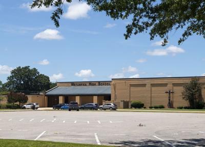
Cliff Williams / TPI Wetumpka High School is continuing to excel with AP exams. It had its highest “pass” rate in the last five years with a 73 and continues to see more students enrolling.
Today’s bullies can be tomorrow's leaders. Students who lurk in the shadows can be too. They just need a little mentoring and willingness to learn.
Wetumpka High School is proving it is possible through a partnership with the Elmore County Resource Center to create the program From Potential to Power.
...COLD WEATHER ADVISORY REMAINS IN EFFECT UNTIL NOON CST SATURDAY...
...WIND ADVISORY REMAINS IN EFFECT UNTIL 9 PM CST SATURDAY...
...EXTREME COLD WARNING REMAINS IN EFFECT FROM NOON SATURDAY TO NOON
CST SUNDAY...
* WHAT...For the Cold Weather Advisory, very cold wind chills in the
single digits are expected. For the Wind Advisory, northwest winds
15 to 25 mph with gusts up to 40 mph expected. For the Extreme
Cold Warning, dangerously cold wind chills as low as 2 below zero
expected.
* WHERE...Barbour, Bullock, Calhoun, Chambers, Cherokee, Clay,
Cleburne, Coosa, Elmore, Lee, Macon, Montgomery, Pike, Randolph,
Russell, Talladega, and Tallapoosa Counties.
* WHEN...For the Cold Weather Advisory, until noon CST Saturday. For
the Wind Advisory, until 9 PM CST Saturday. For the Extreme Cold
Warning, from noon Saturday to noon CST Sunday.
* IMPACTS...Gusty winds will blow around unsecured objects. Trees
could be blown down and a few power outages may result. Frostbite
and hypothermia will occur if unprotected skin is exposed to these
temperatures. An extended period of subfreezing temperatures could
cause pipes to burst.
PRECAUTIONARY/PREPAREDNESS ACTIONS...
Winds this strong can make driving difficult, especially for high
profile vehicles. Use extra caution.
Secure outdoor objects.
Dress in layers including a hat, face mask, and gloves if you must
go outside.
Keep pets indoors as much as possible.
Make frequent checks on older family, friends, and neighbors. Ensure
portable heaters are used correctly. Do not use generators or grills
inside.
To prevent freezing and possible bursting of pipes they should be
wrapped, drained, or allowed to drip slowly.
Use caution while traveling outside. Wear appropriate clothing, a
hat, and gloves.
&&