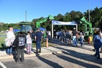
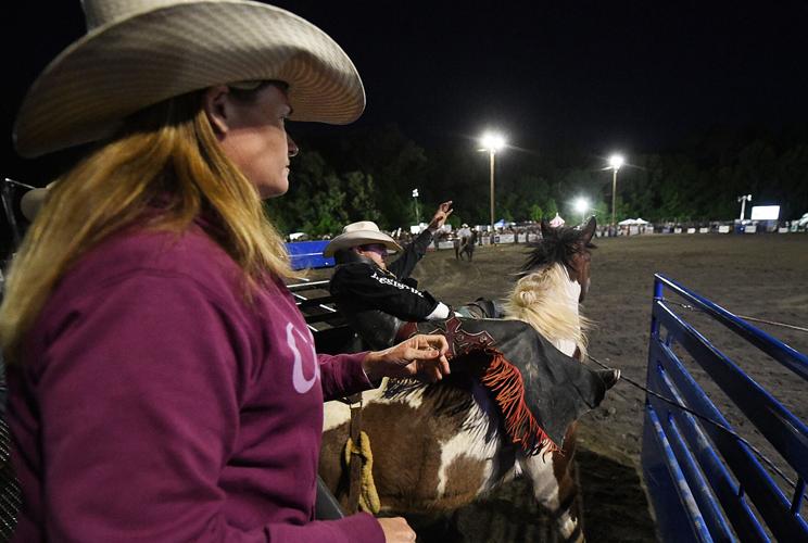
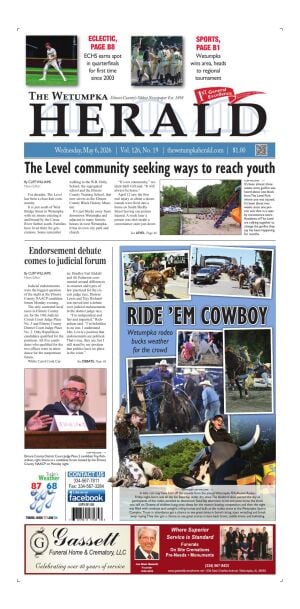
A little rain may have held off the crowds from the annual Wetumpka FFA Alumni Rodeo Friday night, but it was all day fun Saturday under dry skies. The bluebird skies painted the sky as participants of the rodeo paraded to downtown Saturday afternoon to let everyone know the show was still on. Dozens of children hung onto sheep for the mutton busting competition and then the night was filled with cowboys and cowgirls riding horses and bulls at the rodeo arena at the Wetumpka Sports Complex. Those in attendance got a chance to see great times in barrel racing, steer wrestling and break away roping. They also got a chance to see great scores in bare back bronc, saddle bronc and bullriding.
TORNADO WATCH 187 REMAINS VALID UNTIL 11 PM CDT THIS EVENING FOR
THE FOLLOWING AREAS

IN ALABAMA THIS WATCH INCLUDES 34 COUNTIES

IN CENTRAL ALABAMA

AUTAUGA               BARBOUR               BIBB
BLOUNT                BULLOCK               CALHOUN
CHAMBERS              CHEROKEE              CHILTON
CLAY                  CLEBURNE              COOSA
DALLAS                ELMORE                ETOWAH
GREENE                HALE                  JEFFERSON
LEE                   LOWNDES               MACON
MARENGO               MONTGOMERY            PERRY
PICKENS               PIKE                  RANDOLPH
RUSSELL               SHELBY                ST. CLAIR
SUMTER                TALLADEGA             TALLAPOOSA
TUSCALOOSA

THIS INCLUDES THE CITIES OF ALABASTER, ALEXANDER CITY,
ALICEVILLE, ANNISTON, ASHLAND, AUBURN, BIRMINGHAM, BRENT,
CARROLLTON, CENTRE, CENTREVILLE, CLANTON, COLUMBIANA, DEMOPOLIS,
EUFAULA, EUTAW, FORT DEPOSIT, GADSDEN, GREENSBORO, HEFLIN,
HOOVER, JACKSONVILLE, LANETT, LINDEN, LINEVILLE, LIVINGSTON,
LOWNDESBORO, MARION, MILLBROOK, MONTGOMERY, MOODY, MOUNDVILLE,
ONEONTA, OPELIKA, PELHAM, PELL CITY, PHENIX CITY, PRATTVILLE,
ROANOKE, ROCKFORD, SELMA, SYLACAUGA, TALLADEGA, TROY, TUSCALOOSA,
TUSKEGEE, UNION SPRINGS, UNIONTOWN, VALLEY, WETUMPKA, AND YORK.
.Heavy thunderstorms are forecast through early Thursday morning.
This activity has the potential to produce several inches of
rainfall for portions of Central Alabama. A broad area of Central
Alabama is included in a Flood Watch as there is some uncertainty
regarding exactly where the heaviest corridors of rain may occur.

...FLOOD WATCH REMAINS IN EFFECT THROUGH THURSDAY MORNING...

* WHAT...Flooding caused by excessive rainfall continues to be
possible.

* WHERE...A portion of central Alabama, including the following
counties, Autauga, Barbour, Bibb, Blount, Bullock, Calhoun,
Chambers, Cherokee, Chilton, Clay, Cleburne, Coosa, Dallas,
Elmore, Etowah, Greene, Hale, Jefferson, Lee, Lowndes, Macon,
Marengo, Montgomery, Perry, Pickens, Pike, Randolph, Russell,
Shelby, St. Clair, Sumter, Talladega, Tallapoosa and Tuscaloosa.

* WHEN...Through Thursday morning.

* IMPACTS...Excessive runoff may result in flooding of rivers,
creeks, streams, and other low-lying and flood-prone locations.
Creeks and streams may rise out of their banks. Flooding may occur
in poor drainage and urban areas.

* ADDITIONAL DETAILS...
- http://www.weather.gov/safety/flood

PRECAUTIONARY/PREPAREDNESS ACTIONS...

You should monitor later forecasts and be alert for possible Flood
Warnings. Those living in areas prone to flooding should be prepared
to take action should flooding develop.

&&